- Satteläcker 17, 70565 Stuttgart, Germany

Understanding the capabilities of satellite receivers before starting work is crucial. When working with GPS, line of sight between points is not necessary. GPS operates 24 hours a day, seven days a week, and provides accurate geodetic results under nearly any weather conditions. It allows for more observations with less manpower. However, it’s important to be aware of GPS limitations as well. GPS receivers need to connect with at least four satellites. Trees or tall buildings can obstruct the connection with GPS. Additionally, GPS is not suitable for indoor or enclosed space surveying. In some cases, an optical total station may be more appropriate and effective.
Depending on the task, one of several observational methods can be selected:

The primary technique for GPS surveying is static surveying. To observe a long baseline (20 kilometers/16 miles or more), place the reference receiver at a known point. Next, position the second receiver, known as the rover, at the other end of the baseline. Then, set equal intervals for data recording—typically 15, 30, or 60 seconds—and continue the survey by keeping the receivers on for at least one hour. Depending on the baseline length, the number of visible satellites, and the relative geometry of the satellites, you might need more time for the survey. Remember: double-check everything to avoid mistakes. Once sufficient data has been collected, turn off the rover and move on to the next baseline, repeating this process for the new baseline. To expedite the data collection phase, you can add another rover and alternate between the two rovers to survey each baseline.
If you’re working at a site where GPS surveying has never been conducted, you’ll first need to establish several points with known coordinates to calculate transformations. Choose a point for the reference receiver, then move to each of the known points with one or more rovers. Similar to static surveying, the time each rover needs to measure depends on the baseline length and GDOP (Geometric Dilution of Precision). After collecting your data and taking it back to the office for processing, check for errors by re-measuring the same points at different times of the day.

Set up and configure the reference receiver, then place the rover at the other end of the baseline. Ensure that the devices remain stationary, turn on both receivers, and wait for 5 to 20 minutes (this time depends on the number of visible satellites and the baseline length). Once data is collected, you can start moving with the rover. Points can be recorded at predefined time intervals, predefined spatial intervals, or both. In any case, try to avoid obstacles that might block the receiver’s signal. If the receiver’s view of the satellites drops to fewer than four satellites, move the receiver to a location where it can see four or more satellites. In this situation, allow time for phase ambiguity to resolve before resuming the survey.
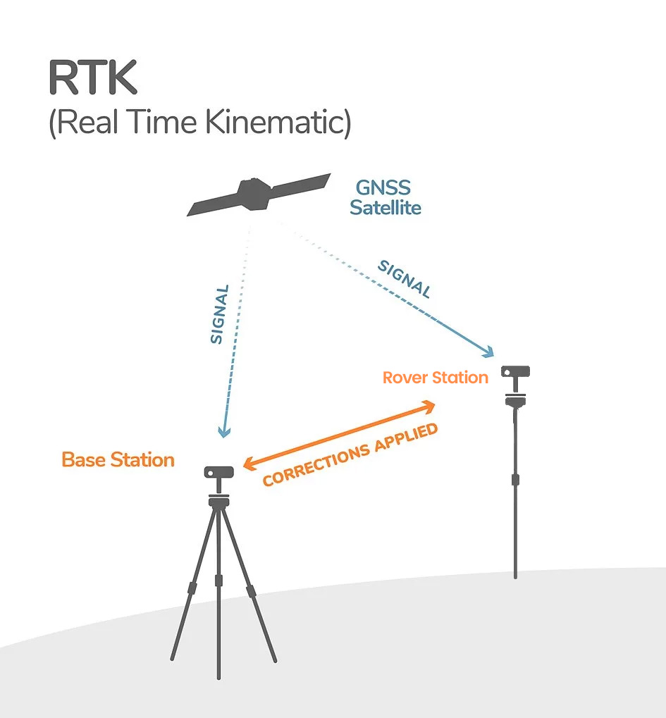
RTK is an alternative to kinematic observations. The rover receiver receives signals from the reference station, but since it also has its own GPS antenna, it directly receives satellite signals as well. The rover then processes both signals to resolve phase ambiguity. Start by setting up and configuring the reference receiver. As soon as the reference receiver begins receiving satellite signals, you can turn on the rover. Wait for the rover to receive both the satellite and reference station signals. Once this happens, the rover will “initialize,” resolving the phase ambiguity and becoming ready to record points and coordinates. Baseline observations using this method achieve accuracy between 1 to 3 centimeters. Ensure that the connection with the reference is not lost, as losing the connection will cause the rover to lose phase ambiguity resolution and accuracy. Monitor the radio modem, as interference in radio waves can disrupt the transmission of corrections. Make sure that antennas are not blocked by tall buildings during both transmission and reception, and avoid using long cables for the antenna, as this can weaken the signals.
References:


Nerxon is set to present its latest advancements in GNSS technology at the upcoming INTERGEO 2024 exhibition in Stuttgart, taking place from September 24 to 26, 2024. This prestigious ...

Advanced Mobile Application and Seamless Integration Nerxon’s mobile application, developed to give users complete control over the device, comes equipped with integrated Augmented Reality (AR) features. This offers an ...

Nerxon Unveils Revolutionary GNSS Technology at INTERGEO 2024 Nerxon is excited to announce the launch of its latest breakthrough in GNSS technology at INTERGEO 2024, a leading global event ...

Nerxon Unveils the N900: A Revolutionary Visual Positioning System with Integrated GNSS Technology Nerxon is proud to announce the release of its latest innovation, the N900—a cutting-edge Visual Positioning ...

+491635197153
Satteläcker 17, 70565 Stuttgart, Germany
info@nerxon.com