- Satteläcker 17, 70565 Stuttgart, Germany

The Mean Sea Level (MSL) is the average height of the ocean’s surface, measured over extended periods, typically a month or a year. This average accounts for short-term variations due to tides and storm surges. Static (or absolute) MSL reflects only changes in sea height, while relative MSL indicates both sea level changes and land elevation shifts at local or regional scales.
Sea level changes occur due to alterations in the volume or mass of water and the shape of ocean basins over geological timescales. Key factors contributing to increased ocean volume or mass include:
Vertical land movements, driven by both natural geological processes and human activities, also impact sea levels. Natural processes include tectonics (e.g., earthquakes) and isostatic adjustments following the last glacial maximum, where land continues to adjust after the melting of ice sheets around 25,000 years ago. Human activities often lead to subsidence, such as from groundwater extraction.
Over hundreds of thousands of years, sea levels have fluctuated by up to 130 meters due to the growth and shrinking of ice sheets during glacial cycles. Paleodata from corals show that during the last interglacial period (about 125,000 years ago), sea levels were 4 to 6 meters higher than today. During the last glacial maximum, sea levels dropped over 120 meters below present levels, rising rapidly until about 6,000 years ago as ice melted. From 6,000 to 2,000 years ago, sea levels rose slowly, with minimal change until recent times.
In recent decades, there has been significant concern about rising sea levels due to climate change and its negative impact on rapidly growing coastal communities. Paleodata from coastal sediments, long-term tidal records (pre-1900), and reconstructions combining tidal data with satellite altimetry measurements indicate a global rise in mean sea level since the late 19th and early 20th centuries. Over the past 3,000 years, changes in MSL were minimal, at most a few tenths of a millimeter per year, while the estimated global average increase in the 20th century was 1.7 mm per year. Satellite measurements show that the rate of sea level rise has nearly doubled in the past two decades. The IPCC’s Fifth Assessment Report predicts that global mean sea levels will likely rise by 28 to 97 cm by 2100.
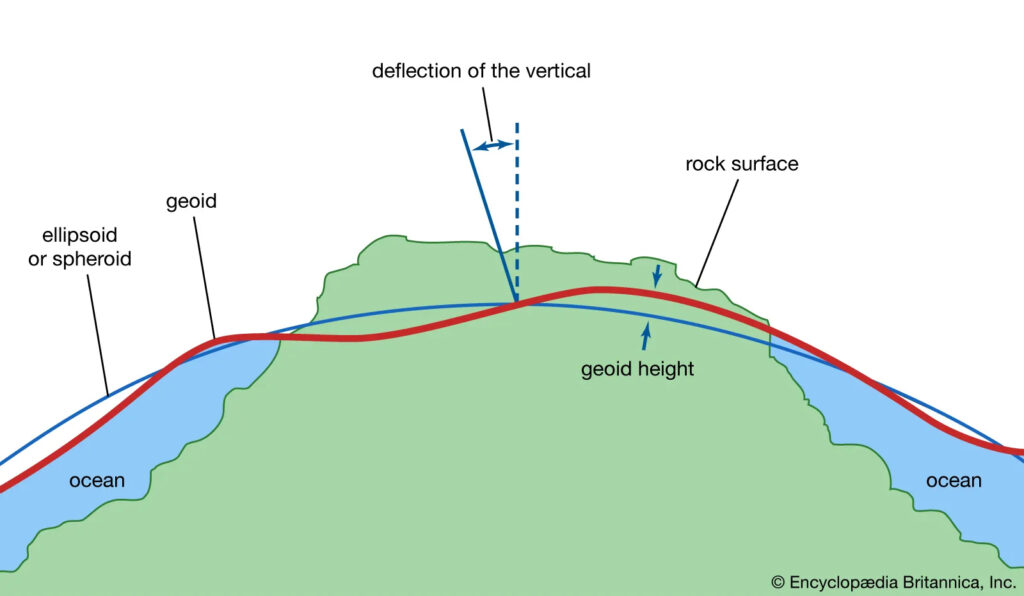
The Geoid is an equipotential surface that best fits the mean sea level across the globe. While we often think of Earth as a sphere, it is actually quite irregular and uneven. The Earth’s radius is greater at the equator than at the poles due to the long-term effects of its rotation. On a smaller scale, topography plays a role – mountains, having more mass than valleys, exert stronger gravitational pull regionally. These large and small variations in the size, shape, and mass distribution of the Earth cause slight changes in gravitational acceleration (or the “strength” of gravitational pull). These variations define the shape of the planet’s liquid environment.
If tides and currents were removed from the oceans, the surface would take on a wavy shape (rising where gravity is strong and sinking where gravity is weak). This irregular shape is called the “Geoid,” a surface that defines zero elevation. Surveyors use complex mathematical and gravitational readings on land to extend this imaginary line across continents. This model is crucial for measuring surface elevations with high accuracy.
– Variations in water mass at different points.
– Temperature differences.
– Gravitational forces from the Moon and Sun.
– Centrifugal force from the rotation of the Earth-Moon system.
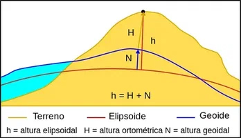
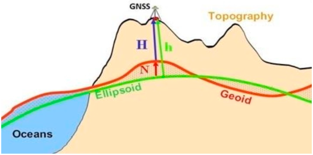
The Geoid is used to convert geodetic heights to orthometric heights and to reduce the volume of leveling operations, which is a costly task. Determining the Geoid requires gravimetric data, but the long-wavelength components of the Geoid height, which are significant in calculations, can be determined using global geopotential models by integrating satellite and ground data. However, short-wavelength components require terrestrial gravimetric data. Geoid height is a crucial parameter in physical geodesy, with one of its essential applications being the determination of the best reference ellipsoid. Various satellite, geometric, and physical methods are used to determine the Geoid. The effects of topographic masses in determining Geoid height are defined in three terms: the direct topographic effect on gravity, the primary indirect topographic effect on potential, and the secondary indirect effect on topography.



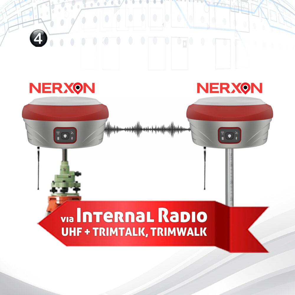


Nerxon is set to present its latest advancements in GNSS technology at the upcoming INTERGEO 2024 exhibition in Stuttgart, taking place from September 24 to 26, 2024. This prestigious ...

Advanced Mobile Application and Seamless Integration Nerxon’s mobile application, developed to give users complete control over the device, comes equipped with integrated Augmented Reality (AR) features. This offers an ...

Nerxon Unveils Revolutionary GNSS Technology at INTERGEO 2024 Nerxon is excited to announce the launch of its latest breakthrough in GNSS technology at INTERGEO 2024, a leading global event ...

Nerxon Unveils the N900: A Revolutionary Visual Positioning System with Integrated GNSS Technology Nerxon is proud to announce the release of its latest innovation, the N900—a cutting-edge Visual Positioning ...

+491635197153
Satteläcker 17, 70565 Stuttgart, Germany
info@nerxon.com